Trollstigen (The Troll's Path)
A staggering 10% incline carving upward through the sheer rock walls of the Norwegian fjords.
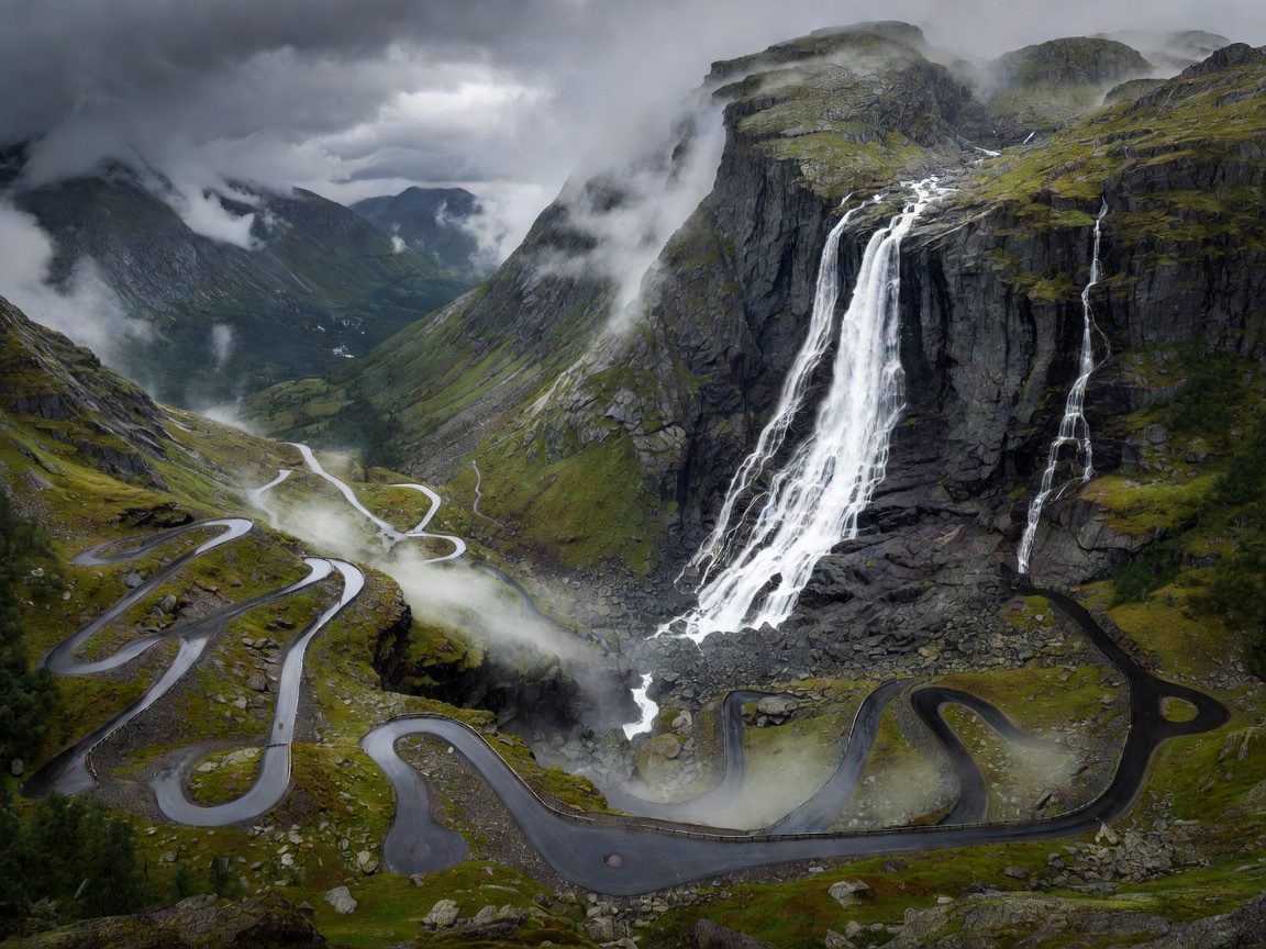
Geographic Overview and Scale
Located in Rauma Municipality in Møre og Romsdal county, Norway, Trollstigen ("The Troll's Path") is a masterpiece of Nordic road engineering. While its peak elevation of 858 meters may seem modest compared to the giants of the Alps, the visual drama of Trollstigen is unparalleled. The route scales an almost vertical mountainside, rising sharply from the lush Isterdalen valley below.
Framed by towering mountain peaks with evocative names like Kongen (The King), Dronninga (The Queen), and Bispen (The Bishop), the road crosses the massive Stigfossen waterfall via a striking stone bridge. The raw power of the plunging water provides a constant acoustic backdrop, underscoring the formidable nature of the Norwegian wilderness.
The Engineering History
Trollstigen was opened by King Haakon VII in 1936 after eight years of arduous construction. Prior to the road's completion, the route was merely a steep, treacherous trail used for centuries by farmers and horses trading goods across the mountains. The engineering required to blast a viable path out of solid gneiss rock was a monumental achievement of the era.
Over the decades, the road has been gradually widened and improved, yet it retains a terrifyingly narrow profile in certain sections. The sheer stone retaining walls, assembled by hand, still border much of the ascent, standing as a testament to the laborers who quite literally carved civilization into the cliff face.
Driving Dynamics and Challenges
With an uncompromising 10% gradient and 11 distinct, tight hairpins, driving Trollstigen is a lesson in vehicle control and spatial awareness. The climb is steep enough to strain cooling systems and transmissions, while the descent requires absolute faith in engine braking. Coasting on the brakes down a 10% grade will lead to catastrophic overheating in a matter of minutes.
The road is exceedingly narrow, meaning large vehicles—such as camper vans and commercial buses—often struggle to navigate the apex of the hairpins without crossing into the opposing lane. Consequently, traffic flow relies heavily on anticipation and courtesy. Drivers must constantly look ahead, utilizing small passing bays to allow oncoming traffic to clear the bottlenecks.
During wet weather, which is remarkably frequent in the western Norwegian fjords, the asphalt loses significant grip, and the spray from the Stigfossen waterfall actively wets the road surface near the stone bridge crossing.
Preparation and Best Practices
Trollstigen is one of Norway's most visited tourist roads, requiring careful planning to enjoy properly.
- Seasonal Closures: The route is completely impassable during the winter months. It typically opens in late May or early June and closes by November, though heavy snowfall can drastically shift these dates. Checking regional traffic advisories is mandatory.
- Timing Your Drive: To avoid the heavy convoys of tour buses that arrive midday, plan your ascent for early morning or late evening. The midnight sun in summer provides excellent visibility even at late hours, offering a surreal driving experience under perpetual twilight.
- Viewing Platforms: At the summit, a striking modern architectural visitor center provides cantilevered viewing balconies extending over the cliff edge. It is highly recommended to stop here to fully comprehend the scale of the route you have just conquered.
Trollstigen is not a road for setting speed records. It is a slow, methodical climb through one of the most dramatically vertical landscapes on Earth, demanding patience and rewarding drivers with visual majesty at every turn.